
Archive Record
Images
Metadata
Catalog Number |
1902.1.23 |
Title |
Little River Project and Camp Charles M. Smith |
Collection |
Maps & Posters |
Object Name |
Plan |
Scope & Content |
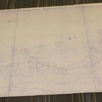
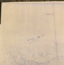
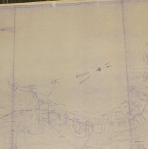
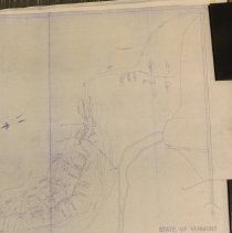
The subject of this drawing is the Little River Project and Civilian Conservation Corps Camp Charles M. Smith in Waterbury VT. It is labeled State of Vermont, Board of Public Works, E. A. Melendy, Chairman. The legend indicates infrastructure elements such as water supply, sewer, steam lines, telephone poles, man holes, etc. The map also shows location of barracks, administration buildings, mess hall, post exchange, fire station, roads, Little River, etc. The plan of the camp was traced from Gov. map survey of the dam, October 1937. Scale is one inch equals 80 feet. Two copies. |
Date |
1937 |
Search Terms |
Waterbury, VT Little River Little River Dam Civilian Conservation Corps Camp Smith, Waterbury, VT |
Subjects |
Survey Maps Sewers Fire hydrants Barracks Camps Roads |
Imagefile |
019\1902123.JPG |